About This Project
Florida’s Guana Tolomato Matanzas National Estuarine Research Reserve (GTM NERR) and the University of Florida’s College of Design, Construction and Planning have received a grant from the National Estuarine Research Reserve System Science Collaborative to work with Matanzas Basin stakeholders to plan for sea level rise in a way that protects communities and the environments they depend on for quality of life and commerce.
The team will use a structured collaborative process to work with planners, property owners, and scientists to identify areas of conflict and agreement related to sea level rise, develop land use scenarios to illustrate the results of different planning decisions, and communicate these scenarios to the general public. Ultimately our goal is to develop a balanced, stakeholder-driven process of planning for sea level rise that can be used throughout the state and serve as a model for other regions.
This project runs from November 2011 to October 2014. Your input is critical to ensure it remains focused on relevant sea level adaptation planning questions and that the resulting information and tools are useful in your work. Check out the Matanzas Project Brief to learn more.
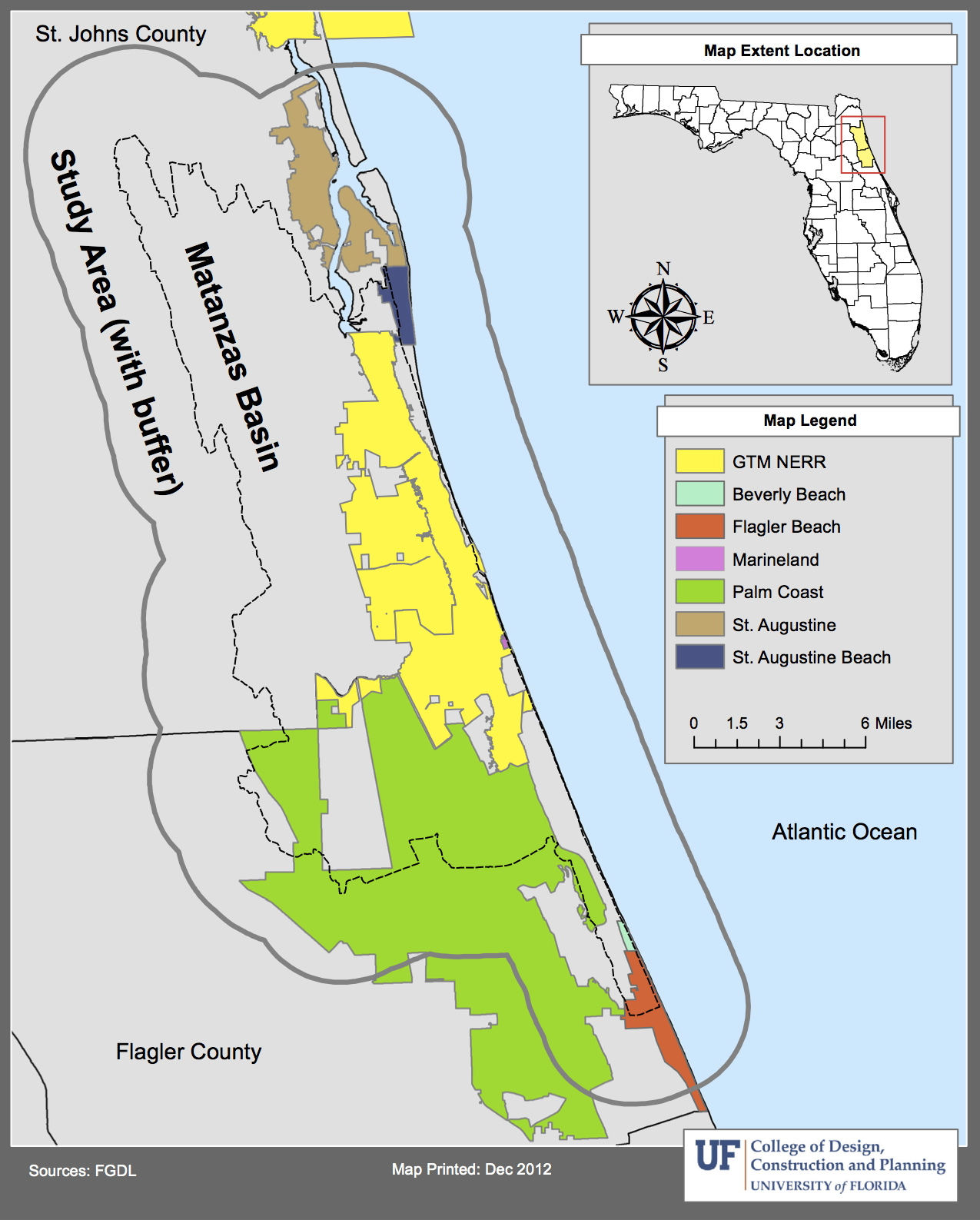
The Study Area
The study area is the Matanzas Basin (or watershed) plus a buffer area that includes the cities of St. Augustine, St. Augustine Beach, Marineland, Palm Coast, Beverly Beach, and Flagler Beach. The study area also includes the unincorporated coastal communities of Vilano Beach, Butler Beach, Crescent Beach, and Summer Haven, and many others east of Palm Coast; and inland communities such as St. Augustine South and St. Augustine Shores. The project team is conducting geographic and ecological analyses, as well as public outreach, in the study area to inform integrated planning for sea level rise.
A map showing the creeks of the Matanzas Basin is below.

University of Florida Research Team

Dr. Kathryn Frank
Assistant Professor
Department of Urban and Regional Planning
University of Florida
Principal Investigator

Dr. Dawn Jourdan
Director and Associate Professor
Regional and City Planning
University of Oklahoma
Collaboration Lead

Dr. Tom Hoctor
Director
Center for Landscape Conservation Planning
University of Florida
Habitat Migration Corridors
Prof. Michael Volk
Landscape Planner and Project Coordinator
Center for Landscape Conservation Planning
University of Florida
Habitat Migration Corridors

Dr. Paul Zwick
Professor and Director
GeoPlan Center
Department of Urban and Regional Planning
University of Florida
Geospatial Analyses
 Prof. Robert Grist
Associate Professor (now retired)
Landscape Architecture
University of Florida
Visualization & Communications

Dr. Greg Kiker
Associate Professor
Department of Agricultural and Biological Engineering
University of Florida
Sea Level Affecting Marshes Model

Dr. Anna Linhoss
Post-Doctoral Researcher
Department of Agricultural and Biological Engineering
University of Florida
Now at Mississippi State University
Sea Level Affecting Marshes Model
Thomas Ruppert, Esq.
Climate and Policy Coordinator
Florida Sea Grant
University of Florida
Adaptation Strategies
Dr. Maia McGuire
Extension Agent
Northeast Florida Sea Grant
Collaboration and Outreach
Dr. Russell Watkins
Geographer
GeoPlan Center (past)
University of Florida
Model Coordination & Evaluation
Current and Past Graduate Students ( * – employed by project)

