
Interview with GTM Research Reserve director Dr. Michael Shirley
- What are the purposes of the GTM Research Reserve?
- What are ecosystem services?
- What is known about sea level rise and its impacts on natural and developed areas?
- What is the project approach, and what stakeholders are involved?
Who is involved in the project?
This project is a collaboration of Florida’s Guana Tolomato Matanzas National Estuarine Research Reserve (GTM NERR) and partners from the University of Florida’s College of Design, Construction and Planning, Department of Agricultural and Biological Engineering, and Florida Sea Grant. A multi-stakeholder Matanzas Basin Steering Committee guides the project at the local level. Intended users of this science and and planning tools include public officials, land owners, businesses, and residents of the Matanzas Basin, and other sites in the National Estuarine Research Reserve System. The project is funded by the National Estuarine Research Reserve System Science Collaborative program, which is in turn funded by the National Oceanic and Atmospheric Administration (NOAA).
What is the timeline for the project?
The project runs from November 2011 to August 2014. In Fall 2012 and Spring 2013, the project team will present sea level rise vulnerability assessments to stakeholder representatives and receive input at focus group meetings. In Fall 2013 and Spring 2014, diverse stakeholder representatives will jointly identify sea level rise adaptation scenarios during facilitated meetings. Finally, in the Summer of 2014, the public and other interested persons will participate in a regional sea level rise adaptation planning workshop that will showcase the project’s accomplishments and set the stage for future planning.
What will the project produce?
Three years of a collaborative process and scientific modeling will result in a report of findings, recommendations, and a planning toolbox to help Matanzas Basin decision makers and stakeholders plan for sea level rise, especially the identification of viable habitat and species migration corridors. The recommendations and planning toolbox will be based upon stakeholder input, vulnerability assessments, ecological conservation designs, analysis of potential land use conflicts, and a governance readiness assessment for future adaptation. The data generated, such as geospatial modeling and analysis results (maps), will be publicly available. Beyond the report and data, we hope to achieve local commitment to continue to plan for sea level rise, with identified processes for doing so.
The project team will document and evaluate the planning process used in the Matanzas Basin to create a transferable planning process and guidebook for use by other sites in the NERR System, state planning and natural resource management agencies, and other coastal areas.
Why is the Matanzas Basin special?
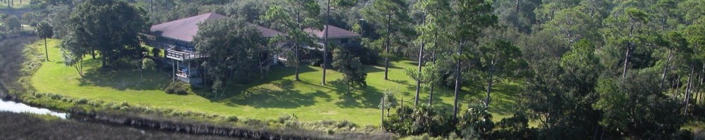
The Matanzas estuary and basin between St. Augustine and Palm Coast, along with the Guana-Tolomato estuary and basin north of St. Augustine, form the Guana Tolomato Matanzas National Estuarine Research Reserve. These areas are among the few remaining pristine, undeveloped places in coastal Florida. They provide many ecosystem services and amenities to the surrounding communities. The 18-minute video below provides a beautiful overview of the GTM Research Reserve.
What is the NERR System?
The National Estuarine Research Reserve System is, “a network of 28 areas representing different biogeographic regions of the United States that are protected for long-term research, water-quality monitoring, education and coastal stewardship”. Established by the Coastal Zone Management Act of 1972, as amended, the reserve system is a partnership program between the National Oceanic and Atmospheric Administration and the coastal states. NOAA provides funding, national guidance and technical assistance. Each reserve is managed on daily basis by a lead state agency or university, with input from local partners.
How does the project incorporate stakeholder and public input?
The Matanzas Basin report will be a product of a structured collaborative process that takes stakeholder and public input and identifies issues of concern related to sea level rise, areas of conflict and agreement, and alternative land use scenarios.
Is there evidence of sea level rise in Northeast Florida?
Tide stations of the National Water Level Observation Network operating on all U.S. coasts, have been measuring sea level rise for over 150 years. The measurements detailed below show that sea level has been rising in Northeast Florida.
According to the National Oceanic & Atmospheric Administration’s tidal stations, the mean sea level trend at the Mayport, Florida, station is 2.40 mm/year based on monthly mean sea level data from 1928 to 2006, which is equivalent to a change of 0.79 feet in 100 years. The mean sea level trend at the Daytona Beach, Florida, station is 2.32 mm/year based on monthly mean sea level data from 1925 to 1983, which is equivalent to a change of 0.76 feet in 100 years.
What will sea level be in the future?
Scientific models generally agree that sea level will continue to rise, and that it will happen faster. Past and future sea level rise is related to the Earth’s warming, which has been occurring since the last Ice Age. With warmer temperatures, two main factors contribute to observed and projected sea level rise. The first is thermal expansion: as ocean water warms, it expands. The second is from the contribution of land-based ice due to increased melting. The major store of water on land is found in glaciers and ice sheets. Global sea level has been projected to rise two to three feet or more by the end of the 21st century, but it will not climb at the same rate at every location. Differences in land movements, strength of ocean currents, water temperatures, and salinity can cause regional and local highs and lows in sea level.
How can we see what areas may be affected by future sea level rise?
This project will use a simple model called the “bathtub model .” The bathtub model essentially uses the ground elevation of an area to predict inundation. For example, if the model is using a scenario of three feet in sea level rise, it is assumed that anything along the coast that is less than three feet in elevation will be flooded. While this model does not take in to account the complexities of an area, such as erosion or existing protective structures that may effect the level of inundation, it does provide an estimate of the areas that may be impacted by changes in sea level. As the prominent statistician George Box said, “All models are wrong, but some are useful.”
The National Oceanic and Atmospheric Administration (NOAA) Sea Level Rise Viewer is an online bathtub inundation mapping tool that anyone can use to see how sea level rise at increments of 1 feet will affect their coastline. As an example, the image below was generated from the NOAA Sea Level Rise Viewer for 3 feet of sea level rise in St. Augustine, Florida.

For this project, we used the best available elevation data to generate maps of low-lying places in the study area. These places will become increasingly vulnerable to inundation by sea level rise over the next 60 years. The resulting map for the entire study area is available below and as a high-resolution pdf file: Study Area Low-Lying Places.

How do we understand the impact of sea level rise on storm surges?
Storm surge is water pushed onto shore by a strong storm or hurricane. Storm surge is regarded as one of the most dangerous hazards of a coastal storm, as it often poses the greatest threat to life and property. Sea level rise has the potential to increase storm surge in areas, increasing the severity of impacts from storms. The project team will use the Federal Emergency Management Agency (FEMA) HAZUS-MH model (or Hazus) to evaluate storm surge in the basin, and to examine how storm surge changes with sea level rise. Hazus uses geographic information system (GIS) technology to model the potential losses from floods and hurricanes. According to FEMA, “the technology can estimate physical, economic, and social impacts of disasters. Users can then visualize the spatial relationship between populations and fixed geographic assets or resources”. Hazus is an excellent tool for pre-disaster planning and is used by government planners, GIS specialists, and emergency managers for mitigation planning.
How do we anticipate habitat changes due to sea level rise?
The Sea Level Affecting Marshes Model (SLAMM) “simulates changes in coastal habitat and shorelines resulting from sea level rise”. The project team will use SLAMM to examine changes in wetland habitat, particularly tidal marshes, and shoreline under different scenarios of sea level rise in the Matanzas Basin The model simulates the dominant processes involved in wetland conversions under different scenarios of sea level rise including the coastal dynamics of inundation, erosion, soil build-up (accretion), soil saturation, and barrier island over-wash.
Why do species and habitats need migration corridors?
A wildlife corridor is, “a tract of land that connects different wildlife habitats (refuges, parks, rivers, etc) that might otherwise be separated by human development. Wildlife need migration corridors to have a better opportunity of finding the basic necessities they need like habitats, food, water, shelter, and places to raise young. Many animals require large territories and corridors provide access to new habitats and maintain a healthy territory size”. The wildlife that migrates relies on corridors to move safely over long distances without having to come into contact with human developments or cars. Wildlife corridors also promote genetic biodiversity. When more individuals of a species are interconnected, the gene pool becomes larger with more viability.
Sea level rise may significantly impact wildlife habitat and corridors along coastal areas. It is critical that migration corridors and refuges account for both the loss and creation of new habitats resulting from sea level rise.
How will we identify potential habitat and species migration corridors?
The project team will work with local stakeholders to identify and evaluate a variety of criteria and methodologies for habitat migration corridor design. The selected design approach will involve spatial analyses using Geographic Information Systems (GIS). The design will take into account scenarios of future development patterns. Habitat migration could result in habitat corridors competing with the same land as human development.
How do we model future development scenarios?
We model future development scenarios to examine potential conflict between land-uses, e.g. urban and ecological conservation land uses competing for the same tract of land. The project is using a goal-driven geographic information systems model called Land-Use Conflict Identification Strategy (LUCIS) that produces a spatial representation of probable patterns of future land use. According to the GeoPlan Center at the University of Florida, LUCIS model results “suggest what lands are highly appropriate for future development, what land should set aside for conservation, and what lands should used for agricultural production of all sorts”. The application of its results can be used to develop alternative land-use scenarios.

