Heritage at Risk

Flagler College view

Principal investigator, Dr. Kathryn Frank, spoke about the Planning Matanzas project at Flagler College on February 10th. Her presentation was part of a year-long speaker series, Heritage at Risk: Climate Change, Coastal Communities & Cultural Resources. In conjunction, Jacksonville’s Florida Times-Union newspaper ran an article on February 16th that featured the Matanzas project and other sea level rise planning initiatives in St. Augustine.

Final Report, Appendices, and GIS Data

Planning_For_Sea_Level_Rise_In_The_Matanzas_Basin cover

The Planning for Sea Level Rise in the Matanzas Basin project has released its final, 304-page findings report: Planning for Sea Level Rise in the Matanzas Basin: Opportunities for Adaptation. Accompanying the report are 13 appendices, which provide additional details of the project’s analytic methods, findings, and adaptation strategies. Also available are the GIS data gathered and produced by the project.

The report is the culmination of over 3 years of sea level rise adaptation planning and public involvement led by an interdisciplinary team from the Guana Tolomato Matanzas (GTM) National Estuarine Research Reserve and the University of Florida, and a 14-member stakeholder Steering Committee. Funding was provided by the National Estuarine Research Reserve System Science Collaborative, a partnership between the University of New Hampshire and the National Oceanic and Atmospheric Administration (NOAA).

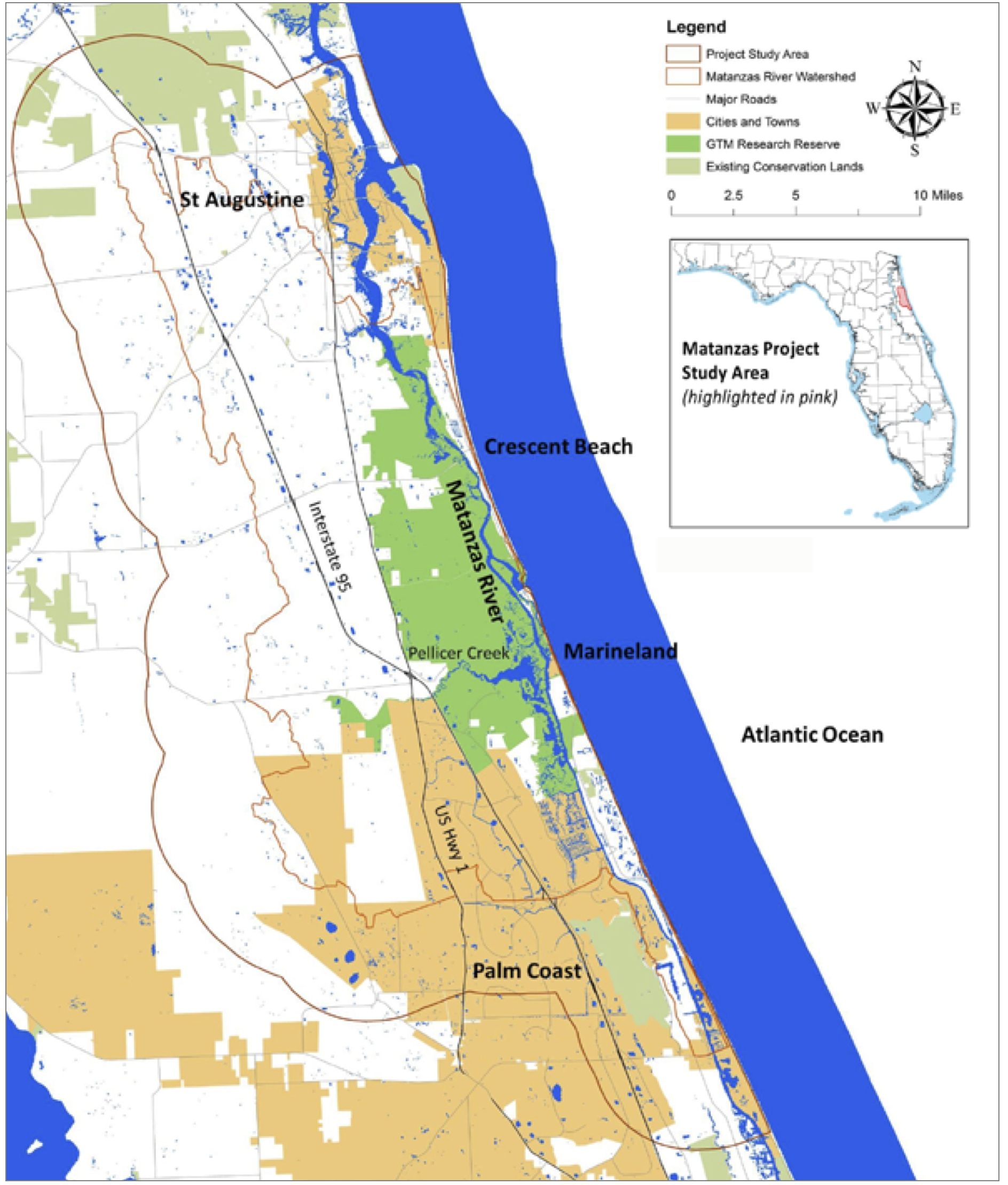
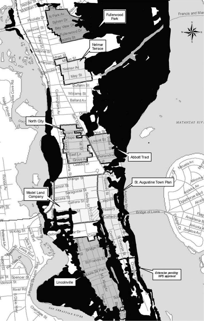
The report’s main audiences are the GTM Research Reserve, and leaders, stakeholders, and citizens in the Matanzas study area in St. Johns and Flagler counties. The 264,000-acre study area, with a total population around 150,000 people, includes the cities of St. Augustine and Palm Coast, and many smaller incorporated and unincorporated communities.

Project study area

Matanzas project study area

The project analyzed current and potential future conditions under scenarios of less than the historic rate of sea level rise (10 inches over the past 100 years) up to a rise of 8 feet (2.5 meters) by the year 2100. The mid-range scenario of 3 feet (1 meter) rise by 2100 could occur as early as 2075.

The project’s main findings relate to the importance of the Matanzas Basin, its vulnerabilities, potential adaptation strategies, and current governance capacity.

Importance of the Matanzas Basin

The Matanzas Basin has rich biodiversity, intact ecosystems, and environmental and cultural assets of state and national significance. The basin’s ecological resources deliver valuable ecosystem services to area residents and businesses. The high population growth rates in the two counties have the potential for creating future land use conflicts between conservation and development interests.

Vulnerabilities

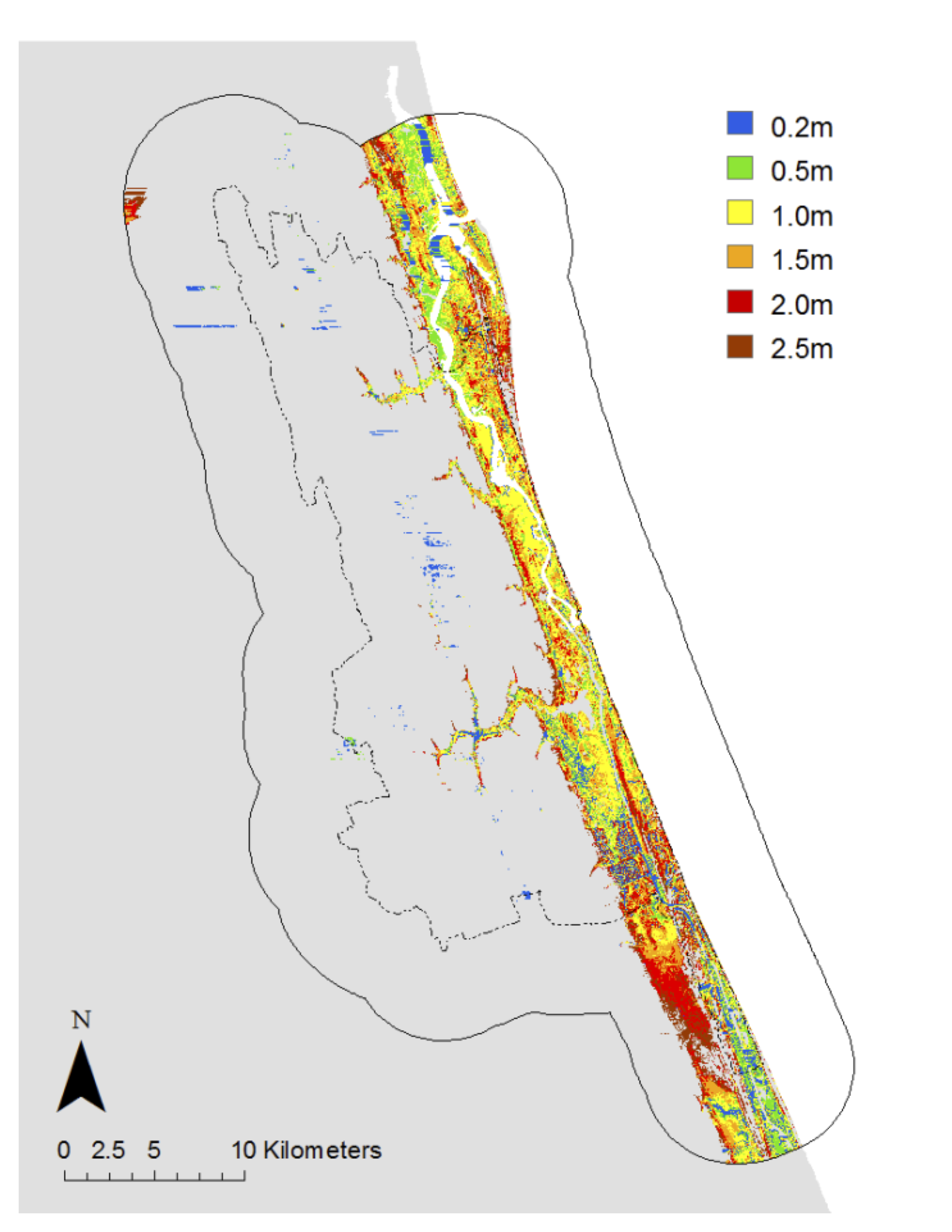
The large study area afforded landscape-level assessments of multiple types of vulnerabilities through integrated, scenario-based geospatial analyses. Sea Level Rise Affecting Marshes Model (SLAMM) analyses drew attention to a 2-mile wide strip of coastline as being highly vulnerable to sea level rise (see figure below). Inland impacts of sea level rise were limited and concentrated along the major streams, such as Pellicer Creek, due to the higher elevations of the Atlantic Coastal Ridge. Just to the west of the study area, future sea level rise impacts were observed in the Lower Eastern Valley due to rising of the St. Johns River.

Areas of change shown for each sea level rise scenario (using SLAMM)

SLAMM changes

Impacts of sea level rise on the natural environment. Some wetland and open water dependent species gained habitat with sea level rise, however the majority saw net loss in habitat. Many of the habitat losses occurred within the GTM Research Reserve, which suggests the need for additional conservation lands to mitigate the losses. Biodiversity hotspots within the basin, such as along Pellicer Creek, had a moderate to high degree of impact.

Impacts of sea level rise on existing development. Residents and stakeholders described current conditions – erosion, flooding, saltwater intrusion, and loss of natural amenities – that may become more severe as sea level rises. The project found that for all the sea level rise scenarios there were forecasted losses of currently developed land, assuming the land is not protected from inundation. In the Matanzas study area, the 3 feet sea level rise scenario affected 2,456 acres of currently developed residential land, which has over 16,000 residential units with more than 30,000 residents.

Impacts of sea level rise on future development. All the sea level rise scenarios forecasted losses of undeveloped dry land, assuming the land is not protected from inundation. In the Matanzas study area, the 3 feet sea level rise scenario affected 1,637 acres of vacant, developable residential land. Under current growth rates, if future development (a) avoids areas vulnerable to 3 feet sea level rise and follows current land use policies, and (b) accommodates the relocation of current development in vulnerable areas, then by 2060 this new development was found to consume property parcels totaling 133,564 acres across the two counties. Currently platted parcels absorbed much of the growth and relocation.

Impacts of future development on the future natural environment. The future development scenario described above impacted nearly all upland natural community types. Many upland species lost 10% to 30% of their habitat to future development, and biodiversity hotspots were affected.

Adaptation Strategies

The large study area and its diversity of land uses led to the identification of a wide range of potential adaptation strategies. Many of the strategies are multi-functional, and oriented towards regional sustainability and resilience, thus they are likely to yield benefits for all future sea level rise scenarios.

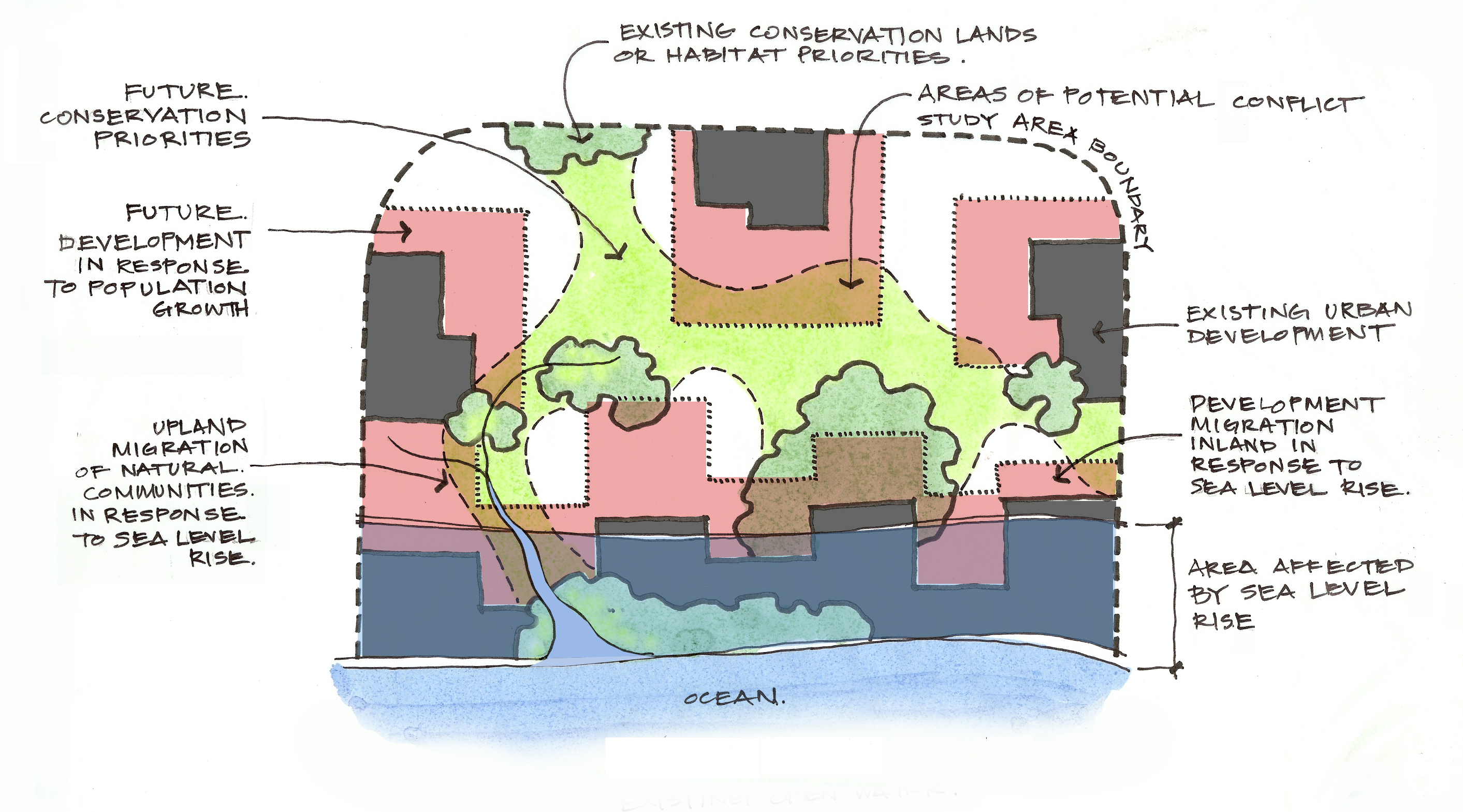
Future conservation priorities. Future conservation priorities highlighted undeveloped areas directly north and south of the GTM Research Reserve to compensate for the loss of estuarine habitats within the Reserve. In upland areas, lands having high conservation priorities included habitats around Pellicer Creek. Aggregated conservation priorities for regional resilience covered most of the Matanzas Basin, which stressed the importance of continuing initiatives for land conservation and best management practices.

Future development to reduce impacts to future conservation priorities. Similar to the “trend” development scenario discussed above, a future “conservation” development scenario was created, which resulted in new development occupying 13,747 fewer acres in total, and impacting 63,800 fewer acres of future conservation priorities, as compared to the trend scenario for the two counties. Within the Matanzas study area, the conservation scenario impacted 20,259 fewer acres of future conservation priorities. The results indicate that policies guiding density and location of development are important for conservation, and that improvements over current land use policies are possible.

Coastal hazard mitigation. To attend to the worsening threats to development from coastal hazards, the project created a toolbox of hazard mitigation strategies modified to explicitly address sea level rise and apply to the Matanzas area. Of particular interest are strategies that integrate designs for the built and natural environments, and that acknowledge the unique challenges posed by adaptation of historical assets.

Governance Capacity and Next Steps

In order to understand the governance context, the project reviewed local and regional initiatives and policies for the goals of land conservation, smart growth, coastal hazards mitigation, and sea level rise adaptation. The review noted early leadership at the level of the Northeast Florida region, however local government plans in the Matanzas area had not yet begun to recognize and address the long-term threat of sea level rise.

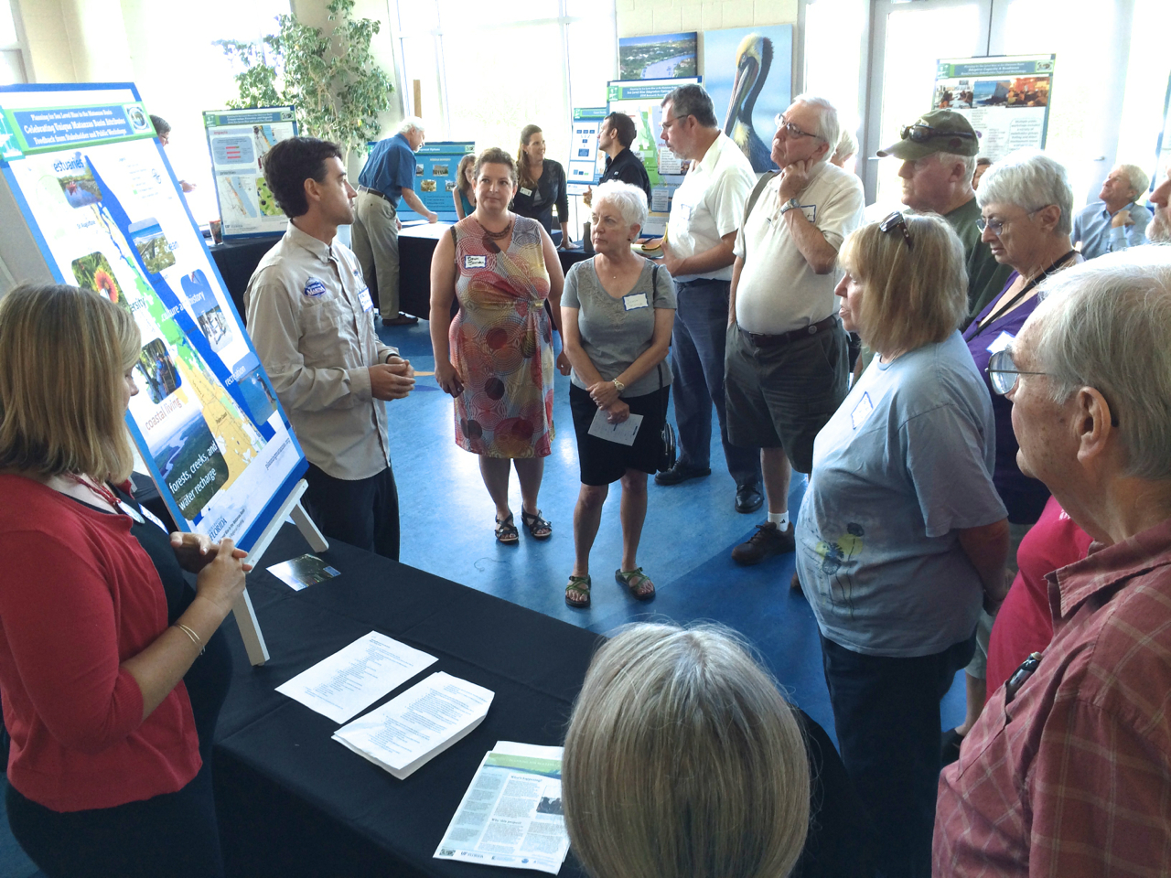
The project’s public input showed that Matanzas area stakeholders and citizens are ready to increase attention to sea level rise concerns. The GTM Research Reserve and the project’s Steering Committee reported that they were already using the information and data from the project, by incorporating it into regular operations and the design of new initiatives. The project’s findings represent a better understanding of the Matanzas area and its future, yet the project was only the beginning of adaptation planning. This work should be regularly updated and combined with information about other future changes as it becomes available.

Princess Place
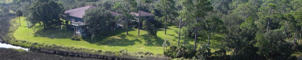
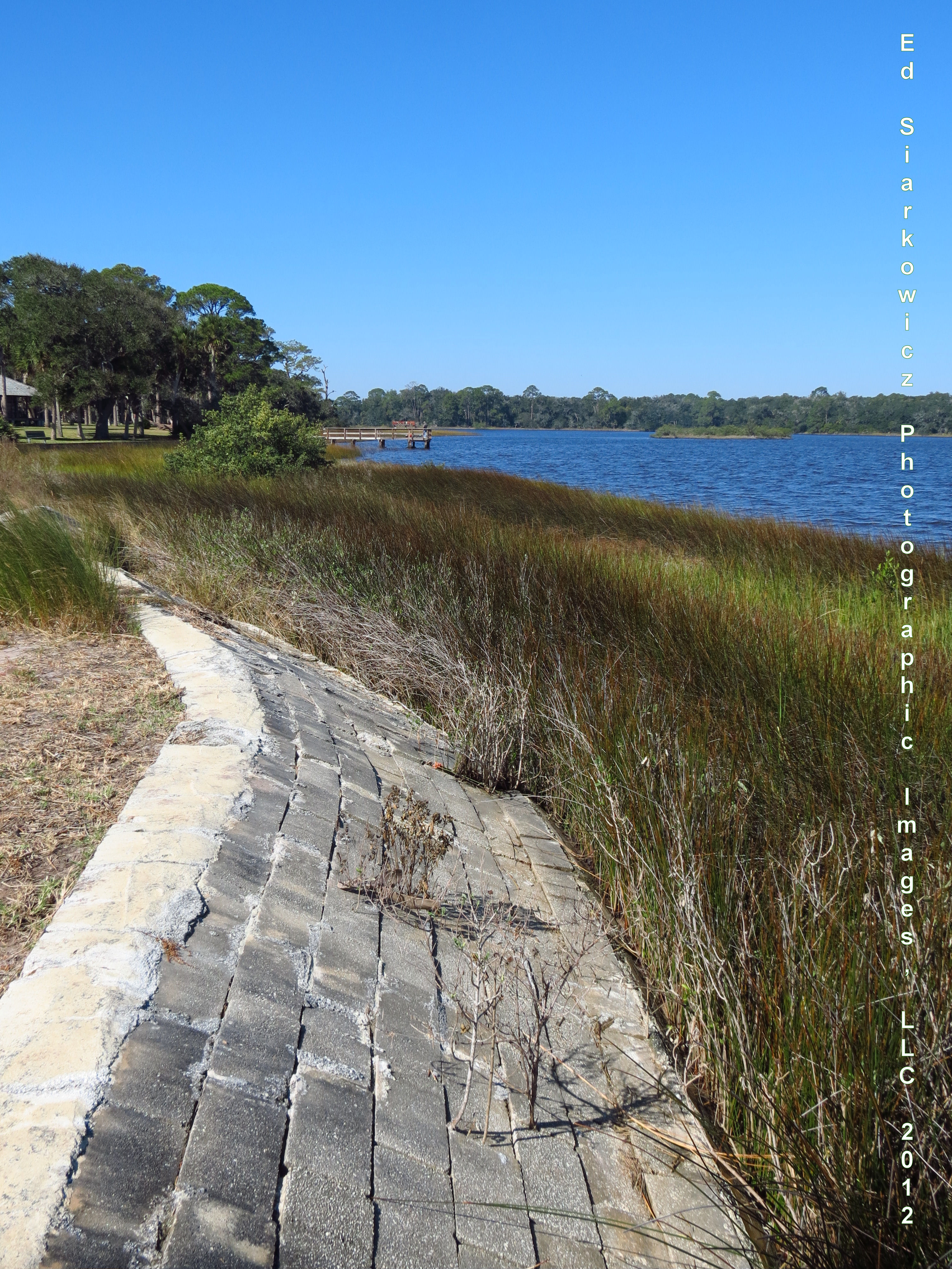
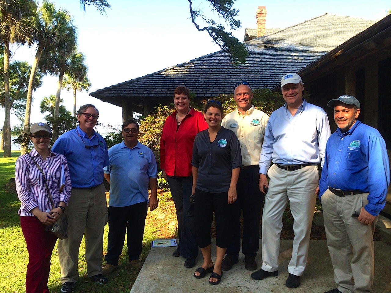
Princess Place, Flagler County/GTM Research Reserve

Final Public Workshop

Final Workshop

September 8th, marked the final public workshop and was held at the Whitney Lab in Marineland. Community leaders, concerned citizens, a student group, and reporters were among the visitors who came to learn about the project’s findings.

Participants, who registered for times available each half hour, began their visit with a short film giving an overview of the project. Afterwards, each group was guided into the atrium where multiple stations had been setup, each presenting major topics of the project. The presenters at each station were members of the project’s Steering Committee, staff of the GTM Research Reserve, and the University of Florida researchers. All the workshop materials (video and posters) are available on the Library page.

A news article resulting from the workshop highlights the leadership of the project and others in Northeast Florida, including the Northeast Florida Regional Council, to begin addressing the issue of sea level rise and yet the tremendous work that remains to be “ready.” Progress is clear-Sea Level Rise_The Florida Times-Union_9-9-14

“The Planning for Sea Level Rise in Matanzas” project is now moving into the final phase of publishing its results by January 2015. The input provided by the public during each workshop has been a valuable source of data that has assisted researchers in gaining a fuller understanding of the efforts needed for sea level rise planning.

Announcement – Final Public Workshop on September 8

The final workshop for the “Planning for Sea Level Rise in the Matanzas Basin” project is scheduled for Monday, September 8, 2014, from 10:00 a.m. to 2:00 p.m. To give participants a chance to interact with project leaders, registration time slots are available each half hour from 10:30am to 12:30pm. The event will be held at Whitney Lab for Marine Biosciences, 9505 Ocean Shore Boulevard in the Town of Marineland.

The final workshop will be held in an open house format. Groups will move through stations to learn about the different components of the project, ask questions, and provide feedback. Project team members and community partners will give presentations. The topics are:

  1. Project overview
  2. Local values of the Matanzas Basin
  3. Sea level rise impacts on the GTM properties
  4. Sea level rise impacts on St. Augustine, Palm Coast and Barrier Islands
  5. Potential adaptation strategies for St. Augustine, Palm Coast and Barrier Islands
  6. Conservation priorities for sea level adaptation and eco-protection
  7. Future development scenarios
  8. Additional potential sea level rise adaptation strategies for GTM
  9. Adaptive capacity and readiness
  10. Ways everyone can be involved

The final workshop is the culmination of several phases of public input over the past three years. The first phase included stakeholder workshops to residents, youth, and professional groups. The research team presented the science of sea level rise, localizing impacts to the Matanzas basin and the surrounding region. Input was gathered from participants about area attributes through a visioning exercise and adaptation strategy preferences with participation in a role play game.

The second phase of public input was the multi-stakeholder workshop. The focus was the intersection between sea level rise, land conservation priorities, and future land development in the region. Part of the process involved the group contemplating the design of conservation corridors to protect habitats of various species whose future would be impacted by sea level rise and development practices. Using a land density exercise, workshop participants were also given the opportunity to envision the degree of density future residents in the area would need to congregate, in order to ensure the availability of natural habitat.

The upcoming event is free with light refreshments provided. To register, visit https://matanzasbasin.eventbrite.com.

Logo in Coast Picture

Senator Whitehouse Tours the Matanzas Basin Project

Senator Sheldon Whitehouse of Rhode Island recently embarked on a tour of the southeastern US to view the current effects of sea level rise and climate change to bring the information back to Congress. The Senator’s four-day trip began in the Carolinas on April 21st and concluded in Miami on April 25th. Among the places he chose to visit was the GTM Research Reserve on the afternoon of April 24th. The Senator and his assistants toured the Reserve’s Environmental Education Center in Ponte Vedra, Castillo de San Marcos in St. Augustine, Fort Matanzas at the Matanzas Inlet, and Princess Place Preserve in Flagler County. Dr. Kathryn Frank presented an overview of the Planning for Sea Level Rise in the Matanzas Basin (see the presentation), which contained information about current and future potential impacts of sea level rise in the area, as well as local preferences and options for adaptation strategies. Additional information on Senator Whitehouse’s “Climate Road Trip” can be found on his website.

UPDATE: Senators Whitehouse (Rhode Island) and Nelson (Florida) gave a presentation about the current and potential impacts of climate change and sea level rise on Florida to the U.S. Senate on May 13, 2014:

IMG_6838 - Version 2Senator Whitehouse observes the living shoreline project at Castillo de San Marcos, St. Augustine.

IMG_6855 - Version 2The senator enjoys the natural beauty of Princess Place Preserve while discussing the new GTM NERR field station for climate change and ecological services research located on site.

IMG_6866 - Version 2At Princess Place.  Left to right: Anna-Marie Laura (Sen. Whitehouse staff), Dr. Gary Raulerson (GTM NERR), George O’Dell (Princess Place Preserve), Dr. Kathryn Frank (UF), Dr. Nikki Dix (GTM NERR), Joseph Burgess (GTM NERR), Senator Sheldon Whitehouse, and Dr. Michael Shirley (GTM NERR).


Large Public Workshop

The Planning for Sea Level Rise in the Matanzas Basin project hosted a large public workshop on February 24th at the Whitney Lab for Marine Biosciences in Marineland. About 70 members of the public as well as professional and stakeholder representatives attended. After a welcome by GTM Research Reserve director Dr. Michael Shirley, project principal investigator Dr. Kathryn Frank and project collaboration lead Dr. Dawn Jourdan presented the results from the first set of Matanzas stakeholder workshops and the latest technical analyses for future scenario planning. The pair explained the high level of acceptance of sea level rise by earlier participants and the residents’ indication that they were already experiencing impacts from sea level rise in the region. The researchers related public preferences to potential sea level rise adaptation strategies such as living shorelines, water storage easements, and incentives for future development to locate inland in carefully selected locations to balance community and environmental values.

Frank and Jourdan shared model-based scenarios of potential future development and conservation priorities in the Matanzas study area created by Drs. Paul Zwick and Tom Hoctor at the University of Florida. The purpose of the scenarios was to inspire dialogue about the relationship between sea level rise, future population growth and development patterns, and environmental conservation. The researchers showed the impacts of these phenomenon on habitats in the region for three species with diverse needs: shorebirds, gopher tortoises, and black bears. The researchers presented future land development scenarios that would allow the region to accommodate changes in the natural and built environment without sacrificing needed natural habitat.

Next, Lia Sampson, Coastal Outreach Coordinator, led workshop participants in a SWOT (Strengths, Weaknesses, Opportunities, and Threats) analysis of the proposed conservation strategy.  Last, Belinda Nettles, a doctoral student of Urban and Regional Planning at the University of Florida, and a team of student assistants facilitated a land development game which permitted small groups of residents to envision their ideas about future development on a hypothetical 700 acre tract. Electronic polling of individuals at the beginning and end of the workshop demonstrated a gained interest by participants to have their local governments promote infill development to meet future conservation and development goals.

Presentation slides and game instructions are available on the library page

Lecture_5

Drs. Frank and Jourdan along with Lia Sampson take closing questions and comments from Matanzas residents. The workshop SWOT analysis can be seen beneath the presentation screen.

Team_1_Playing4

Dr. Jourdan discusses strategy with with Team 1 during the land development game.  Participants on each of the six teams had to determine their group’s goals for meeting rising population demands while balancing conservation needs.

team 5

Team 5 closes in on a development strategy.  Areas providing habitat for focal species can be seen on the right side of the hypothetical site map in green.  Areas already heavily developed with mixed residential and commercial use are located on the left.

team 3 map

Team 3’s final proposal.  Game pieces represented various residential unit densities that could be located as each team saw fit within their overall development goals.  Seventy-five total pieces were necessary to reach the target level of accommodation for incoming residents.

Game_Responses

Team response matrix categorizing the design and development priorities of each participating team as well as final impressions and feedback.

State of the Reserve 2014

February 7th marked the fourth annual State of the Reserve held by the GTM NERR in St. Augustine, Florida.  Titled 2014: Changing Tides, the event was hosted at the GTM Research Reserve Environmental Education Center and featured multiple presentations as well as poster displays of current professional and student research within the reserve.  Opening remarks and introductions were made by program facilitator Tina Gordon and environmental administrator Mike Shirley.  The focus of this year’s meeting centered around rising sea level due to climate change, changes in water quality, and shifts in habitat and species’ health.  Presentations included subjects such as current surveys of Carolina diamondback terrapins in the NERR, mangrove expansion into salt marsh habitats, and the efficacy of coastal restoration projects in science and education.  The research center also presented updates on the current state of its programs and facilities as well as future outreach and education goals within the community.  More information about the reserve can be found on their website.

Sixth Steering Committee Meeting

The project’s sixth Steering Committee meeting was held on December 9, 2013 at the GTM NERR Marineland Office. The project’s Collaboration Lead, Dr. Dawn Jourdan, presented a draft presentation for the next stakeholder workshop to be held February 24, 2014. The presentation included the information that the project team learned from  the first stakeholder workshops in Fall 2012 and Spring 2013, as well as new results from the project’s technical analyses of future land use and habitat conservation design. The team was fortunate to have UF researchers Dr. Paul Zwick and Dr. Tom Hoctor on hand to answer questions. Overall, the meeting was very productive and the Steering Committee members provided valuable feedback on analytic inputs and how to communicate the technical results to the public.

ConceptSketch rev10-1Conceptual sketch presented at the meeting, illustrating the project team’s technical analyses of future land use and habitat conservation design with adaptation to sea level rise.

Project in the News: “Think or Swim”

This month’s Landscape Architecture Magazine features the Planning Matanzas project in “Think or Swim,” by Jonathan Lerner. Some of you may remember Lerner, who attended our Spring 2013 professional stakeholder workshops. In his exposition of our project, Lerner does a wonderful job of capturing the unique and vulnerable beauty of the Matanzas Basin as well as the complexity of the planning task at hand.

Click on this image to view a PDF of the article.

First to set the scene, Lerner describes watching the role-play game. He draws comparisons between the role-play game and a childhood favorite, Monopoly; except in our game, “raging competition” detracts from a successful outcome. Lerner then goes into describing the challenges with moving populations and development away from the coast. Not only is the potential impact of sea level rise almost incomprehensible, but long-term coastal residents feel a profoundly strong sense of place. And, as Lerner points out, society continues to privilege coastal living. Ed Montgomery sums it up in the article, “We’re just willing to take the risk to be where we are because it’s absolutely gorgeous.”

The article includes some of our project’s SLAMM maps and Lerner provides a good explanation of how these maps give useful information for planning. He covers the challenges with predicting sea level rise impacts, including the need for a diverse group of individuals working together on this effort.

The article closes with Lerner’s experience traveling around the Basin with Ed Montgomery, a member of our steering committee and director of real estate marketing and sales at Rayonier. He reflects on the issue of habitat conservation given the anticipated migration of natural systems and human systems. As Dr. Dawn Jourdan explains at the article’s conclusion, our project is about providing information and education to the community. It will ultimately be up to the local decision-makers, leaders, and residents to decide which planning course they would like to chart.

Landscape Architecture Magazine is the monthly magazine for the American Society of Landscape Architects. The magazine, which has a readership of 60,000, features planning and design projects across North America. View the November 2013 issue of Landscape Architecture Magazine here.

Threat of Sea Level Rise Impacts on Historic St. Augustine

As we’ve been examining the potential impacts of sea level rise in and around the Matanzas Basin, Ann Horowitz has been examining the potential impacts of sea level rise on historic St. Augustine. Horowitz recently connected with our project to share her findings. Specifically, Horowitz explored the effects of sea level rise on St. Augustine’s National Register historic districts and the need for adaptation as part of her historic preservation master’s thesis for Goucher College, near Baltimore, Maryland. She found that the impacts of sea level rise could significantly compromise the future of St. Augustine’s unique architectural and cultural heritage by 2100.

As Horowitz describes in her study, St. Augustine is no stranger to coastal adaptation. As early as 1599, the Spanish recognized the need for protection after a severe ocean storm damaged the early settlement. St. Augustine’s first seawall was constructed of timber between 1596 and 1602. Two coquina stone seawalls followed: Spain financed the first seawall completed in 1705 while the U.S. engineered the second between 1836 and 1842. (Fig. 1) The National Park Service constructed a rip-rap living seawall in 2011 to protect the nineteenth century historic seawall adjacent to the Castillo de San Marcos. (Fig. 2) In addition, the new Avenida Menendez seawall rehabilitates and protects the historic seawall between St. Francis Street to the Santa Marina Restaurant.

With a sea level rise projection of one foot by 2050, the shoreline could migrate closer to the historic district boundaries, increasing the probability of damaging floods, storm surge, and coastal erosion. A projected three-foot sea level rise by 2100 may permanently inundate portions of six St. Augustine historic districts. (Fig. 3) More frequent floods, higher storm surges, wetlands migration, and coastal erosion could impact all seven districts, resulting in the degradation or demolition of irreplaceable historic properties. For example, wetlands could migrate into the Lincolnville Historic District, potentially undermining the foundations of many historic buildings, leading to their collapse.

Furthermore, coquina stone and tabby are vulnerable to erosion and disintegration. (Fig. 4) Many of St. Augustine’s oldest historic buildings and structures are constructed with these lime-based building materials. Due to rising carbon emissions, the increasing acidity of ocean and rain water causes the dissolution of lime-based substances. Historic properties of coquina and tabby, such as the Castillo de San Marcos and the “Oldest House,” will eventually decompose if permanently inundated in acidic floodwater (Fig. 5).

In her thesis, Horowitz provides a sobering image of St. Augustine’s future due to the tremendous loss of historic properties that reflect the city’s rich cultural legacy. Adaptation solutions, such as the Avenida Menendez seawall and the city’s recent stormwater improvements, will minimize the effects of sea level rise on the historic districts. Nonetheless, additional adaptation strategies based on sea level rise projections are needed to further protect historic St. Augustine’s distinctive architectural and cultural heritage, critical to maintaining the city’s economic and social vitality.

Interested in learning more about sea level rise impacts on St. Augustine’s historic districts and adaptation? See Horowitz’s link to her thesis abstract and chapter on St Augustine here. For additional information on National Register historic district vulnerabilities to sea level rise and adaptation solutions, contact Ann Horowitz at annhorowitz@me.com or (703) 629-5343.

Fig. 1: The city’s third reconstructed seawall guards the area now known as the St. Augustine Town Plan Historic District. [John S. Horton, Library of Congress Geography and Map Division; View of St. Augustine, East Florida, 1855]

Fig. 2: The rip-rap seawall, as seen at low tide, was constructed by the NPS to reduce erosion on the historic seawall and to create a natural habitat. [© Ann Horowitz, January 2013]

Fig. 3: With a one meter (three feet) of sea level rise by 2100, a substantial portion of the city is likely to be affected. Inundated areas are illustrated in black. All historic districts will be impacted by sea level rise to some degree. [City of St. Augustine; historic district base map, October 2011. National Oceanic and Atmospheric Administration; sea level rise and coastal flooding impacts three feet rise overlay, n.d.]

Fig. 4: Part of the nineteenth century coquina seawall borders the Castillo de San Marcos. At low tide, the deterioration from wave action and dissolution as a result of acidic water is evident. [© Ann Horowitz, January 2013]

Fig. 5: The Gonzalez-Alvarez or “Oldest House” is the earliest residential building in the city. It was constructed in the early 1700s of coquina and tabby. The building could be permanently inundated by 2100. [© Ann Horowitz, January 2013]